IN THE
WAKE
|
|
Chartiers Flood Control Authority informed the public about the Army Corps of Engineers' plans to dredge the Chartiers Creek channel and clear-cut along the banks in order to return the creek to the flood control design pre-hurricane Ivan. Concerns were raised that clear-cutting the banks will only increase water runoff and sediment influx. The larger water volume and increased sediment entering the creek could actually increase flooding problems, especially for those low lying communities further downstream.
Parts of the creek that were
not in the original flood control plan, like McKees Rocks, will not have
sediment removed, and are the furthest downstream, so their flooding problems
could be worse as a result of the dredging and clear-cutting. |
|
The original flood control project was designed to send as much water down
the creek as quickly as possible. This worked for many years to control the seasonal
flooding. However, with the development of surrounding land, in years of higher
rainfall, it causes too much water to flow
down the creek all at once, causing a peak flow that exceeds the creek's
capacity and overflows the banks. What is needed is to slow the water
down, not speed it up. |
|
A design of 50 years ago when most of the surrounding land was rural does not address the more urban land use of today, where shopping malls, parking lots and housing developments have created impermeable surfaces that do not soak up the rainwater. The rain has to go somewhere, so it runs off down the slopes and adds greater volumes of water to the tributaries and to the creek - all at once - instead of slowly releasing the rainwater from the absorbent vegetated ground over time.
Using existing natural
floodplains and natural vegetation as a riparian buffers to collect and
hold the overflow is the newest flood control concept and is not only a more aethetically
pleasing visually, but a much more functional design than the concrete walls
and rip-rap used a half century ago. This natural floodplain at Wingfield
Pines beautifully demonstrates the capacity to hold floodwater without
damage. |
|
It is up to the Army Corps of Engineers, who designed the original Fulton Flood Control project, to update the flood control design to take the additional water volumes into account. To avoid worse flooding scenarios, the Army Corps must re-study and re-design the flood control on Chartiers Creek to address not only the current land use, but also to include newer technology and best management practices, by using natural floodplains like Wingfield Pines, Crafton and Windgap to add water storage capacity to the design, along with the artificial levees and rip-rap we have now.. In conjunction with better designed flood control, low lying communities need to hold upstream communities responsible for unregulated development that sends large volumes of instant runoff downstream. This happens even during normal storm events. But, unless communities voice their concerns, the Pennsylvania Department of Environmental Protection does not require developers to design a stormwater management plan that keeps their stormwater on site. Unless the citizens complain, the developer can have a plan approved that will merely send the water on down the creek.
Abandoned mine drainage projects and municipalities following the federal stormwater mandates are cleaning up the creek and improving the water quality. Cleaner water increases the recreational value of the creek. It is not the open sewer it was a half-century ago when the flood control project was first implemented at the request of a handful of business owners, concurrent with the I-79 interstate planning and expected business corridor development. |

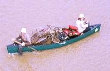
Dredging and clear-cutting now will only serve to destroy this emerging recreational resource for watershed residents. Those of us interested in developing the creek's recreational potential urge the Chartiers Valley Flood Control Authority and the US Army Corps of Engineers to adopt an integrated approach to stormwater management that reflects the recreational uses of the creek and technical advancements of this century rather than sending the creek back to the way it was fifty years ago. |
|
|