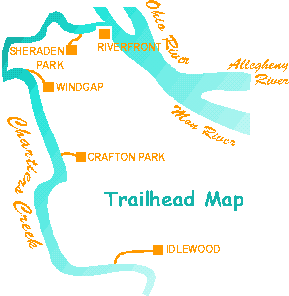
A vital link to other area trails, it is our goal for the Chartiers Trail to initially connect with the city trail system at the Ohio River. Eventually it will intersect the Montour Trail and link to the Panhandle Trail, which extends to Weirton, West Virginia. The first step is linking the lower urban 8 miles into a continuous trail accessed at the following trailhead points:
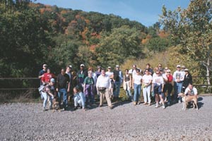
The idea of a greenway started over a decade ago with a vision and a handful of volunteers. Beginning in East Carnegie at the Idlewood wetlands trailhead, the inaugural hike through the urban section of the proposed Chartiers Trail took 35 trailblazers (shown by the Scully Yards railroad bridge) all the way to Pittsburgh's proposed riverfront park on the bank of the Ohio River.
Although vital land has been conserved since then, little has been done to join the fragmented sections of existing trail and conserved land into one greenway park. The last improved access remains at Sheraden Park, a 15 minute walk from the point where Chartiers Creek flows into the Ohio River.
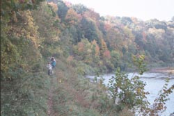
The first leg from Carnegie to Crafton, above, might have been the most scenic. It is certainly the only leg with an existing improved trail. But the potential beauty of the entire creekside is clear. As former Pittsburgh councilman Alan Hertzberg pointed out, "This would be such an amenity - make it a more attractive place to live."
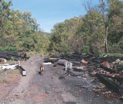
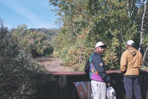
Using canoes, makeshift pulley systems and old-fashioned grit, volunteers have managed to haul out over four tons of trash which had been illegally dumped. Still, much remains to be done. And lost opportunities, like the abandoned Scully Yards rail-to-trail project, above, stand as sad testimony to the lack of conservation leadership and community support.
Various private and government owners control the land along the creek. Unlike the Panhandle and the 11-mile Montour Trail, which was built on exclusively on abandoned railroad rights-of-way, the Chartiers Trail faces the additional challenge of requiring extensive land acquisition efforts. Estimates of the cost to acquire this land or obtain conservation easements, and construct the trail is between $15,000 to $20,000 per mile.
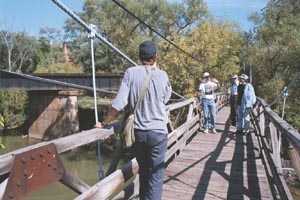
Hikers pause to take in the view from several old scenic bridges spanning the creek. Time is of the essence if we are to preserve these historic bridges and the important wetland, grassland and woodland wildlife habitats that they cross. Already, the pedestrian bridge near McKees Rocks, shown above, was destroyed during hurricane Ivan and has not been rehabilitated or replaced. Another key bridge, the Turner Bridge, by the Idlewood wetlands, was recently demolished by the Flood Control Authority and Allegheny County. Much of the land is under severe development pressure, despite being prone to landslides and floods.
before its too late!